Search
Close this search box.

SECTION 102: ZIGLAB TO BEIT IDIS

  • HIKES IN THE REGION​

  • DAY 2: ZIGLAB TO BEIT IDIS

  • Distance: 22.4 km

  • Time: 8 hours

  • Physical Challenge: Difficult

  • Trail Challenge: Difficult

  • Waymarked: Yes

To download the Jordan Trail GPS tracks, click here

The Jordan Trail is a newly established trail, and is not marked. It is therefore our strong recommendation that you hire a local guide for your safety as many sections are remote with limited water sources and at times no connectivity.
By downloading these maps/GPX you take full responsibility for their use and accuracy; Jordan Trail Association does not warrant the accuracy or completeness of the information, materials or the reliability of any maps as they provided AS IS without warranty of any kind, either express or implied, including but not limited to, fitness for a particular purpose, or non-infringement ;You acknowledge that any reliance on any such maps, shall be at your sole risk and responsibility as Hiking, backpacking, and other outdoor activities all have potential hazards involving risk of injury or death. Outdoor activities have inherent risks and you should ensure you have the skill level and abilities suitable for the activities in Jordan to partake in them and to take all precaution measures.  Check the data on Google Earth or other Apps or Programs before using them.  The Jordan Trail Association shall not be held responsible for any incidents that may occur during your participation in any activity and/or by using any of the maps/GPX.
AGREE
Click Icon

The Jordan Trail is a newly established trail, and is not marked. It is therefore our strong recommendation that you hire a local guide for your safety as many sections are remote with limited water sources and at times no connectivity.
By downloading these maps/GPX you take full responsibility for their use and accuracy; Jordan Trail Association does not warrant the accuracy or completeness of the information, materials or the reliability of any maps as they provided AS IS without warranty of any kind, either express or implied, including but not limited to, fitness for a particular purpose, or non-infringement ;You acknowledge that any reliance on any such maps, shall be at your sole risk and responsibility as Hiking, backpacking, and other outdoor activities all have potential hazards involving risk of injury or death. Outdoor activities have inherent risks and you should ensure you have the skill level and abilities suitable for the activities in Jordan to partake in them and to take all precaution measures.  Check the data on Google Earth or other Apps or Programs before using them.  The Jordan Trail Association shall not be held responsible for any incidents that may occur during your participation in any activity and/or by using any of the maps/GPX.
AGREE
close-link
to download the map
IMPORTANT NUMBERS

Tourism Police:

Hotline: 117777
What’s App: +962 7 7099 1814

* When contacting Tourism Police for emergency identify that you are hiking the Jordan Trail, state your nationality, location and map name & number.


JTA office: +962 6 461 0999

(Working Hours: 9:00 a.m. to 5:00 p.m., Sunday- Thursday)

BASIC INFO

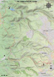
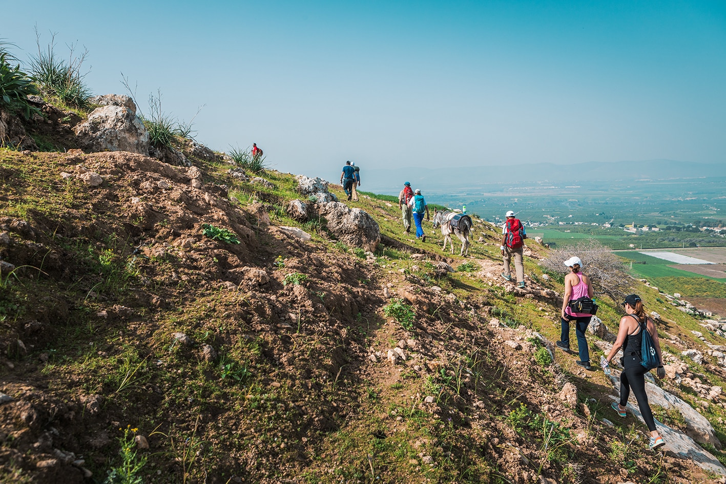
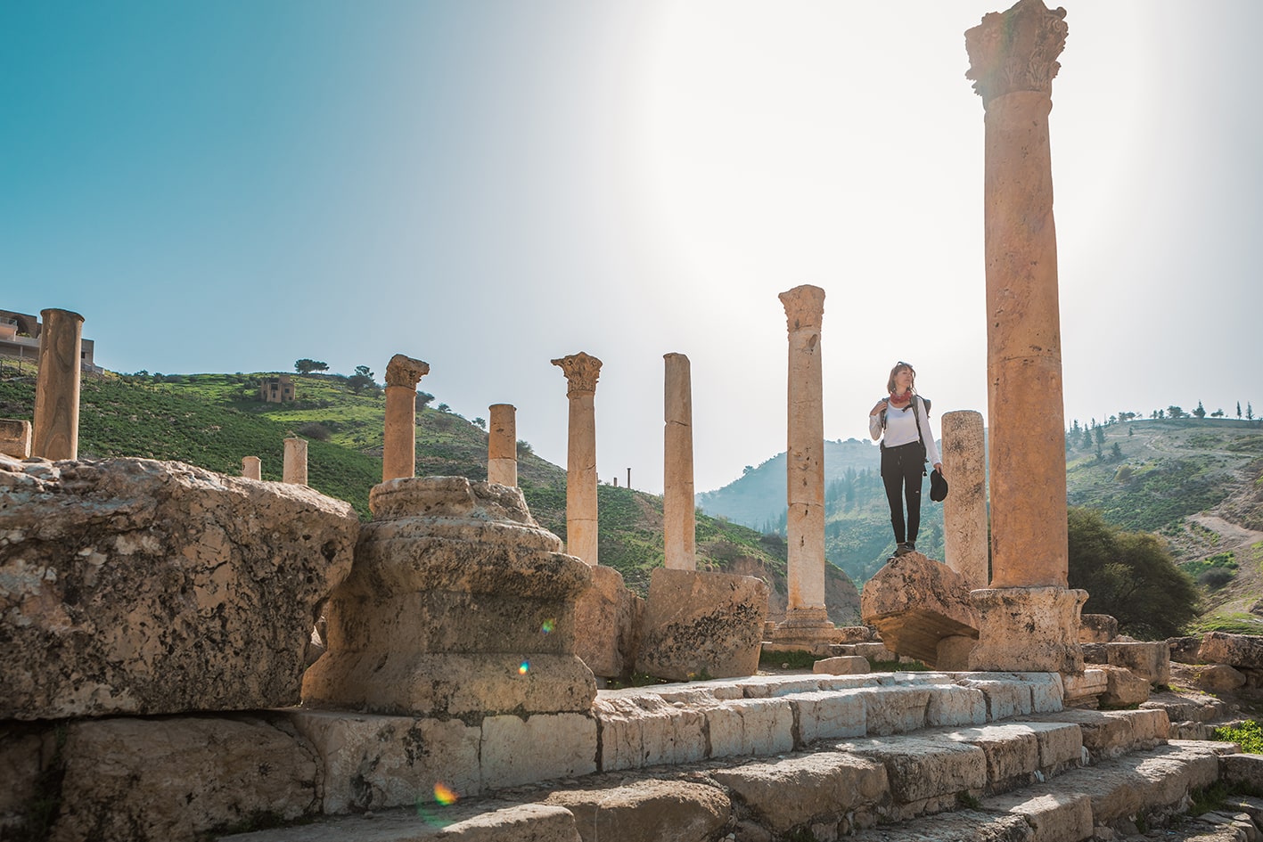
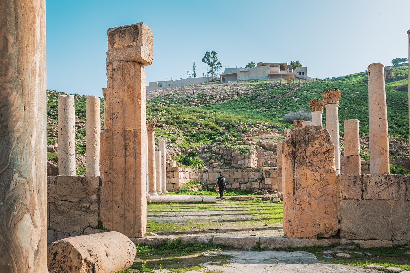
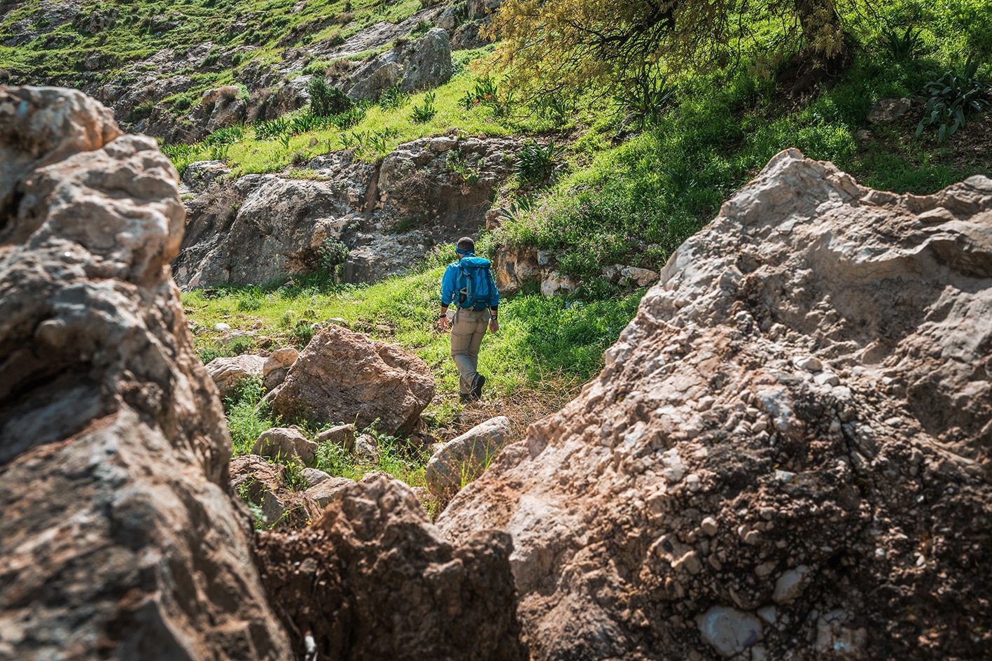
The way heads south from the Sharhabil bin Hassneh gate rising gently around hills directly above the sub sea level agricultural plain of the Jordan Rift Valley to which it briefly descends, passing by fields before rising into the hills. Continuing south, paths and tracks cross the hilltops before a good track descends SW to the hot springs and natural arch beyond which a country lane leads to the Greco-Roman ruins of Pella with the Rest House on the hill above and the Countryside Hotel and homestays in the village of Tabgat Fahl below. We continue up the side of the impressive valley of Wadi el Jirim directly behind the ruins to emerge through pine trees onto upland meadows. Still following the line of the valley up, now called Wadi Sir you pass the ruins of a Byzantine Church and on to the ‘Jesus Cave’ before heading for the village of Beit Idis.

TRANSPORTATION
  • Bus service to Beit Idis from Irbid
  • Private drivers (vans) between villages – ask someone for a driver to a certain plain and negotiate a price.
LOCAL CONTACTS / ACCOMMODATION
  • Homestay, the Golden Spikes Association, Fadi Meqdadi,+962772114138
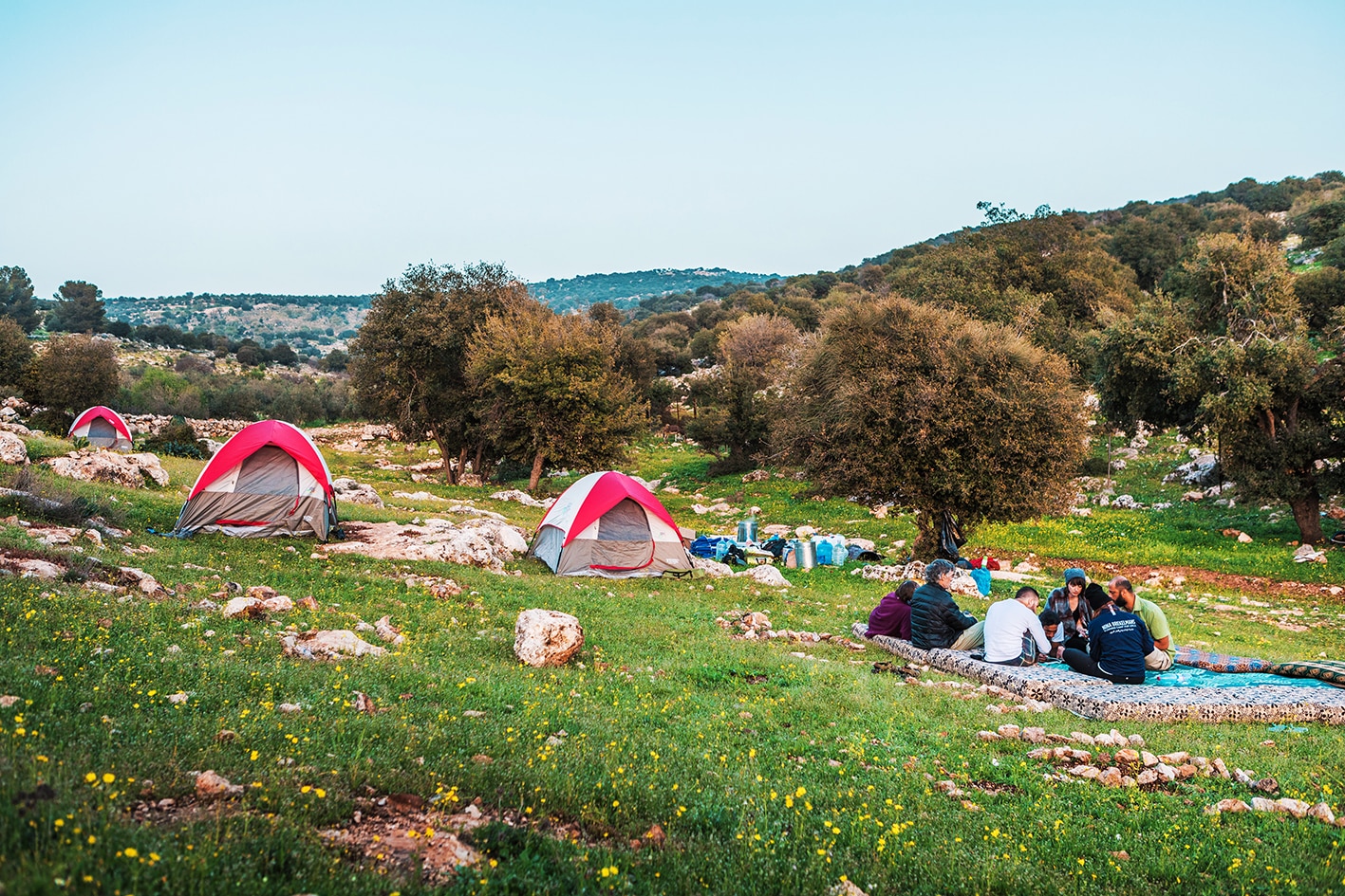
  • Wild Camp, Yehya Mubarak, +962787443710
  • Pella Countryside Hotel, Mohammad Jawahrah, +962797055901, www.pellacountrysidehotel.com
  • Homestay, Beit Al Fannan, +962776667660, barakadestinations.com
  • Homestay, Mohammad Al Dwaikat, +962772293291 , JT Pass Stamp Rasoun
THINGS TO SEE
  • The Jordan Valley
  • Bird Migrations
  • Natural stone arch
  • Hot springs
  • Pella ruins
  • The “Jesus Cave” or “Olive Press Cave”
  • Beit Idis
FOOD & WATER

Food:

  • Tabqat Fahel – shops (off route)
  • Beit Idis – shops

Water:

  • Qatara Spring (purify before drinking)
  • No water confirmed as available at the Pella Visitor’s Center. Tabqat Fahel is located nearby off route.
  • Various houses throughout the day.
  • Beit Idis
TIPS & SAFETY

Tips:

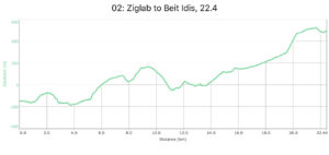
  • Be prepared for a long distance with a steep climb near the beginning, followed later by a long climb uphill from Pella out of the Jordan Valley.
  • Route is waymarked and used frequently.

Safety Info:

  • Exposed edges – A few short sections soon after Ein Um Qais and after Pella
  • Flash flood dangers – Crossing wadis, as well as a few parts of Wadi Sir where narrow, but generally not that risky.
  • Animals – Watch for shepherd dogs.
  • Dehydration/heat exhaustion – This is an issue at lower elevations, but not as bad as the previous day as hottest part of the day is higher in elevation. After Pella, more from large oak trees can be found.
  • Military base – Steer clear of military area just before Pella, sticking to the marked path.

The Jordan Trail is a newly established trail, and is not marked. It is therefore our strong recommendation that you hire a local guide for your safety as many sections are remote with limited water sources and at times no connectivity.
By downloading these maps/GPX you take full responsibility for their use and accuracy; Jordan Trail Association does not warrant the accuracy or completeness of the information, materials or the reliability of any maps as they provided AS IS without warranty of any kind, either express or implied, including but not limited to, fitness for a particular purpose, or non-infringement ;You acknowledge that any reliance on any such maps, shall be at your sole risk and responsibility as Hiking, backpacking, and other outdoor activities all have potential hazards involving risk of injury or death. Outdoor activities have inherent risks and you should ensure you have the skill level and abilities suitable for the activities in Jordan to partake in them and to take all precaution measures.  Check the data on Google Earth or other Apps or Programs before using them.  The Jordan Trail Association shall not be held responsible for any incidents that may occur during your participation in any activity and/or by using any of the maps/GPX.
AGREE
close-link

The Jordan Trail is a newly established trail, and is not marked. It is therefore our strong recommendation that you hire a local guide for your safety as many sections are remote with limited water sources and at times no connectivity.
By downloading these maps/GPX you take full responsibility for their use and accuracy; Jordan Trail Association does not warrant the accuracy or completeness of the information, materials or the reliability of any maps as they provided AS IS without warranty of any kind, either express or implied, including but not limited to, fitness for a particular purpose, or non-infringement ;You acknowledge that any reliance on any such maps, shall be at your sole risk and responsibility as Hiking, backpacking, and other outdoor activities all have potential hazards involving risk of injury or death. Outdoor activities have inherent risks and you should ensure you have the skill level and abilities suitable for the activities in Jordan to partake in them and to take all precaution measures.  Check the data on Google Earth or other Apps or Programs before using them.  The Jordan Trail Association shall not be held responsible for any incidents that may occur during your participation in any activity and/or by using any of the maps/GPX.
AGREE